
Before you book
Walking up Kilimanjaro is roughly equivalent to walking from the equator to the arctic in a week. The five bands are the reason the mountain feels like several different places.
Walking up Kilimanjaro is roughly equivalent to walking from the equator to the arctic in under a week. You pass through five distinct ecological bands, each with its own temperature, vegetation, light and feel, and the transitions between them are abrupt enough to notice within an hour.
It is the single strangest thing about the mountain, and it is why the packing list looks excessive until day six.
1. Cultivation — 800 to 1,800 m
The lower slopes, and the only zone most climbers experience from a vehicle window. Volcanic soil and reliable rain make this some of the most fertile farmland in Tanzania — coffee, bananas, maize, and the villages that grow them. Warm, green, densely populated.
You drive through this zone to the gate rather than walking it.
2. Rainforest — 1,800 to 2,800 m
Day one on most routes. Dense equatorial montane forest, enormous trees hung with old man's beard lichen, ferns, and a permanent green half-light. Humid and warm, and the wettest part of the mountain in every month.
Black-and-white colobus monkeys are common overhead. Elephant and buffalo pass through, though you are far more likely to see the sign than the animal. This is also the noisiest part of the mountain — birds, insects, dripping water — which becomes noticeable in retrospect, because everything above it is silent.
3. Moorland — 2,800 to 4,000 m
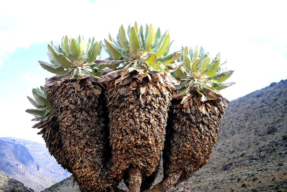
The forest thins abruptly, usually within a single hour of walking, and you emerge onto open heathland. Giant heather first, then the plants Kilimanjaro is famous for: giant groundsels standing several metres tall and giant lobelia, both of which look prehistoric because in evolutionary terms they nearly are.
Warm in direct sun, cold the moment it goes. This is also where most people first notice the altitude — usually as slight breathlessness on a slope that should not cause it.
4. Alpine desert — 4,000 to 5,000 m
Vegetation stops almost entirely. What remains is bare volcanic rock, red-brown scree and scattered boulders under an intensely blue sky. Daily temperature swings here are enormous: fierce sun by day, hard frost overnight, and very little humidity in either.
Extremely little grows because there is almost no water — precipitation falls lower down, and what lands here evaporates or freezes. It is the most lunar part of the mountain and, for many people, the most memorable to walk through.
5. Arctic — 5,000 to 5,895 m
Scree, ice and glacier. Roughly half the oxygen of sea level, permanent sub-zero temperatures at night, and brilliant equatorial sunlight reflecting off the ice. Nothing grows.
The glaciers here — the ones you see on the crater rim at sunrise — are the reason Kilimanjaro looks the way it does from a distance, and they have retreated dramatically over the last century.
| Zone | Altitude | Typical day temp | Character |
|---|---|---|---|
| Cultivation | 800–1,800 m | 25–30°C | Farmland and villages. Driven, not walked. |
| Rainforest | 1,800–2,800 m | 20–27°C | Humid, green, loud. Wettest zone. |
| Moorland | 2,800–4,000 m | 12–18°C | Giant heather and groundsel. First altitude effects. |
| Alpine desert | 4,000–5,000 m | 5–15°C | Bare rock and scree. Huge day–night swing. |
| Arctic | 5,000–5,895 m | −5 to 5°C | Ice, glacier, half the oxygen. |
Which routes show you the most
All the standard routes pass through every zone, but the time you spend in each varies. The western approaches — Lemosho and the Northern Circuit — spend longest in the moorland and alpine desert, which is where the strangest scenery is. Marangu spends the most time in rainforest. Rongai crosses drier northern terrain where the forest band is thinner and the moorland more arid.
See the zones on a route profile
Every route page shows where you sleep in each band, and the comparison tool lets you see how the routes differ.
More on before you book